
Trail Status
| Table 2-2: Growth of the Greenway Network, Comparative Mileage | |||
|---|---|---|---|
| Built Miles Included in Greenway Plans | |||
| Off-road Routes | 1995 Plan | 2007 Plan | 2018 Plan |
| Appalachian Trail++ | 37.2 | 37.2 | 79 |
| Back Creek Greenway | 0 | 0 | 0.4 |
| Barnhardt Creek Greenway | 0 | 0 | 0 |
| BioMed Loop (included in other routes in 2018) | Not included | 1.5 | Removed |
| Birding and Wildlife Trail Sites (miles not included elsewhere) | Not included | 7.5 | 18.75 |
| Blue Ridge Parkway Trails++ | 19.5 | 16 | 30.5 |
| Carvin Creek Greenway | 0 | 0 | 0 |
| Carvins Cove Trail Network | Not included | 38.6 | 56 |
| Catawba Greenway | Not included | 0 | 0.7 |
| Dry Creek Greenway | 0 | 0 | Removed |
| Dry Hollow Greenway | 0 | Removed | Not included |
| Explore Park Trails | 0 | 7 | 14 |
| Garden City Greenway (formerly Garnand Branch) | 0 | 0 | 0.7 |
| Gish Branch Greenway | 0 | 0 | 0 |
| Glade Creek Greenway | 0 | 0 | 0.3 |
| Gladetown Trail | 0 | 0.6 | 0.7 |
| Glenwood Horse Trail | With National Forest Trails | ||
| Green Hill Park Trails | Not included | 0.9 | 2.8 |
| Hanging Rock Battlefield Trail | 0 | 1.7 | 1.8 |
| Havens Wildlife Management Area Trails+ | Not included | 20.3 | 20.3 |
| Horners Branch | 0 | Removed | Not included |
| Horse Pen Branch | 1 | Moved to Carvins Cove Trails | |
| Jefferson National Forest Trail++ | Not included | 8.2 | 139.8 |
| Lick Run Greenway | 0 | 3 | 4.6 |
| Long Ridge Trail | Not included | 0 | 0 |
| Masons Cove Greenway | Not included | 0 | 0 |
| Mason Creek Greenway | 0 | 0 | 1 |
| Mill Mountain Greenway | 1.9 | 3.5 | 3.3 |
| Mill Mountain Park Trails | 2.8 | 8.2 | 9.9 |
| Mudlick Creek Greenway (& Garst Mill) | 0 | 0.5 | 0.5 |
| Murray Run Greenway & Fishburn Park Trails | 0 | 2.8 | 2.8 |
| Paint Bank Branch | 0 | Removed | Not included |
| Perimeter Trail | Not included | Mileage in other routes | |
| Poor Mountain Preserve Trails + | 0 | 0 | 3.4 |
| Read Mountain Trails | 0 | 0 | 4.5 |
| Roanoke River Greenway | 0 | 3 | 13.7 |
| Roanoke River Greenway Extensions | 0 | 0 | 0 |
| Roanoke River Tributary (Franklin St.) | 0 | Removed | Not included |
| Spring Hollow Trails | Not included | 0 | 0 |
| Tinker Creek Greenway | 0 | 1.2 | 3.3 |
| Wolf Creek Greenway | 0 | 2.2 | 2.2 |
| Subtotal | 62.4 | 163.9 | 414.9 |
| On-road Bicycle Connections | 1995 Plan | 2007 Plan | 2018 Plan |
| Bike Lanes | 0 | 1.1 | 47.9 |
| U.S. Bicycle Route 76 | 9.6 | 13.7 | 55.5 |
| Signed Bike Routes | 0 | 9.9 | 31.9 |
| Subtotal | 9.6 | 24.7 | 135.3 |
| Total | 72 | 188.6 | 550.2 |
| + State Jurisdiction; ++ Federal Jurisdiction | |||
Future Trails
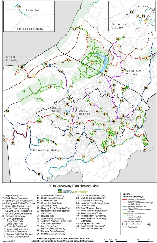
Please refer to the 2018 Greenway Plan Map for information about future routes or read more about how the Plan was developed.