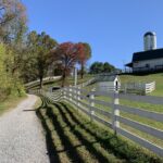
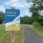
Garden City Greenway
Garden City Greenway is a two mile, paved, neighborhood greenway that connects the Garden City area to Roanoke River Greenway. Started as a Safe Routes to School project, the upper portions are wide sidewalks along Garden City Boulevard, providing connections to the elementary school, businesses, and Garden City Recreation Center at Hancock Park. The lower […]
Trail Details
Trail Distance:
2.03 mile
Amount of Use:
medium
Trail Difficulty:
easy
Surface Type:
Paved