Carvins Cove is a 12,000 acre watershed, protecting a 630-acre reservoir, used for the region’s drinking water. The Western Virginia Water Authority manages the reservoir and boat landing access; Roanoke Parks and Recreation manages the 12,000 acres and 60 miles of trails. The trails are managed for hiking, mountain biking and horseback riding, with some restricted to only one or two uses for safety reasons.
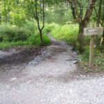
The trails are accessible from five trailheads: the boat landing, Bennett Springs, Timberview, Hanging Rock, and the Hollins Trailhead. Trails are open 6 am to 11 pm, but the boat landing area and Hollins trailhead are open only dawn to dusk.
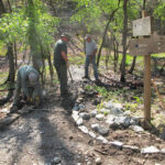
A land use pass is required to use the trails at the Cove and can be purchased online, at the boat landing or at trailhead parking lots.
Hours
Boat Landing at the Reservoir and Hollins Lot:
• April 1 through September 30: Seven days a week, 6:30 am – 9:30 pm
• October 1 through March 31: Seven days a week, 8:30 am – 6:30 pm
Bennett Springs and Timberview Parking Lots:
• 6:00 am – 11:00 pm, year-round
The Trails
Users new to Carvins Cove will want to study the map and get a general idea of the layout before heading out. The descriptions below are organized geographically to indicate options from different access points.
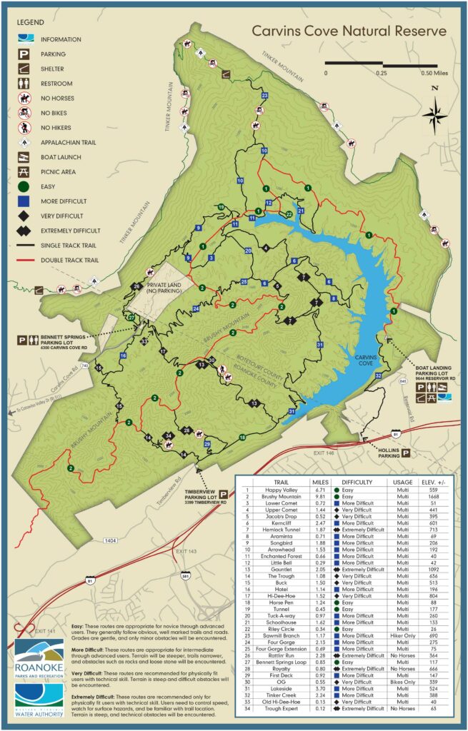
Trails from the Boat Landing
(9644 Reservoir Road) and Hollins Trailhead (8375 Plantation Road)
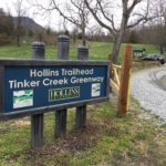
Tinker Creek Greenway (#32 on the Carvins Cove map) connects the Hollins Trailhead to the Boat Landing. Starting on the back side of Hollins University campus, this intermediate trail starts with steady climbing, first through pines and then hardwoods. It crosses under a large powerline, crests the ridge, and then is a steady downhill to the Boat Landing parking lot. There are great views of the reservoir in winter and opportunity for bear sightings. Stay on the trail, as it is often close to private land.
Happy Valley Trail (#1 on the Cove map) is one of the arterial routes through the Cove, going from the Boat Landing to the end of Carvins Cove Road, which is a mile from Bennett Springs parking lot. This is an easy, unpaved road, a major connector, intersecting many trails along the way. Users wanting a long but easy ride could go out to Riley’s Loop and back. Those wanting more challenge could take intermediate options like Schoolhouse or Arrowhead.
Sawmill Branch (#23)
Trails from Timberview Trailhead
(3399 Timberview Road)
Horsepen Trail (#18) is an old road, generally running downhill to the reservoir. It is easy, with connections to intermediate and advanced trails.
Trough (#14) is an intermediate, steady climb from Horsepen to Brushy Mountain Fire Road. The Expert line was developed to give mountain bikers more challenge on the downhill run; no horses on the Expert line.
First Deck (#29) was built to provide an intermediate loop off of Horsepen, for those developing their skill levels.
Royalty (28) is an advanced mountain bike trail, generally ridden downhill from Brushy Mountain. No horses on Royalty.
Gauntlet (#13) is a steep climb from Horsepen to Brushy Mountain. There is an alternate line near the top (OG) that is for mountain bikes only.
Lakeside (31) is generally a contour trail, climbing in and out of multiple drainages, to Hemlock Tunnel. It provides remoteness and occasional views of the reservoir.
Trails from Hanging Rock Trailhead
(1918 Dutch Oven Road)
Hinchee Trail provides a two mile steady climb from Hanging Rock Battlefield Trail to Brushy Mountain Fire Road. It is managed by Roanoke County, but provides a direct connection to the western end of the Cove. It is often used as an out and back. The closest Cove trails are Buck and Trough.
Trails from Bennett Springs Trailhead
(4300 Carvins Cove Road)
Bennett Springs parking area is the largest and most heavily used parking lot for trail users.
Easiest Options
Bennett Springs Loop (#27) is a one mile, easy loop, directly across the road from the parking lot.
Carvins Cove Road to Happy Valley (#1) – Carvins Cove Road provides a one mile, paved route to Happy Valley Trail. This road is open to cars and all users should be very cautious of traffic. Happy Valley from this end connects to numerous intermediate “lower” trails, as well as to Brushy Mountain Fire Road and the 1000’ climb. A longer, but easy out and back is to take Happy Valley to Riley’s Loop, on the water’s edge, and return utilizing portions of Enchanted Forest.
Hotel (#16), close to the parking lot, is a causeway type trail, weaving around, over and through the creek. Then it climbs steadily to reach Midway Cruise and Buck.
Intermediate Options
Brushy Mountain Fire Road (#2) is the second arterial road through the Cove. It starts just inside the gate where Carvins Cove Road hits Happy Valley (#1) and climbs steadily to reach an upper ridge. It continues on up, down and around til it reaches Hinchee Trail on the far end. This route connects to the upper end of several difficult, downhill trails, including Hemlock Tunnel (#7), Gauntlet (#13), Hi-Dee-Hoe (#17), Royalty (#28), Trough (#14) and Buck (#15).
Four Gorge (#24), reached from the lower section of Hi-Dee-Hoe, is a contouring trail to Brushy Mountain Fire Road, providing an off-road access for reaching the trails in the central part of the Cove. It twists and winds through multiple drainages with only moderate elevation gains.
Midway Cruise is a two mile trail similar to Four Gorge in style – in and out of multiple drainages – going from Hi-Dee-Hoe in the opposite direction to connect to Hotel shortly before it reaches Buck. Hotel to Midway to Hi-Dee-Hoe is a nice loop, close to the parking lot.
Lowers and Uppers – There are multiple intermediate trails in the central part of the Cove, accessed from Happy Valley or Brushy Mountain, making loop options possible. These include Songbird (#9), Arrowhead (#10), Tuck-a-way (#20), Four Gorge Extension (#25), Comet (#3), Kerncliff (#6).
Advanced Options
The advanced trail options include:
Rattlin’ Run (#26) is a climbing, contour trail that connects the Bennett Springs Loop to Songbird. It is challenging with twists and turns and numerous rock slabs and ridges. This trail is not recommended for horses, due to slippery rock faces.
Jacob’s Drop (# 5), Hemlock Tunnel (#7), Gauntlet (#13), Hi-Dee-Hoe (#17), Royalty (#28), Trough (#14) and Buck (#15) are advanced trails that generally run downhill from the Brushy Mountain Fire Road. They are steep, rocky, and rough.