
Tinker Creek is a major tributary of Roanoke River, over twelve miles long, and a greenway along this corridor has always been included in greenway plans. The headwaters begin in Botetourt County, and the corridor is rich in natural and cultural resources, including many historic structures such as old mills and houses like Monterey, Bellmont, and Harshbarger. The creek is an urban trout stream and connects eight parks, two golf courses, and six schools. The first section of the greenway from Roanoke River to Wise Avenue opened in 2003, and another section from Hollins University to Carvins Cove opened in 2012. The 2018 Greenway Plan includes a study of alternative locations for Tinker Creek Greenway (Appendix E). The City of Roanoke has begun design of its next section from Wise Avenue to Mason Mill Park and expects to go to construction in 2022-2024.

Interactive Trail Map

The Tinker Creek Greenway System
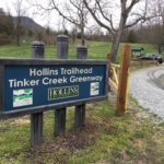
Tinker Creek Greenway from Hollins University to Carvins Cove Boat Landing
(#32 on the Carvins Cove map) connects the Hollins Trailhead to the Boat Landing. Starting on the back side of Hollins University campus, this intermediate trail starts with steady climbing, first through pines and then hardwoods. It crosses under a large powerline, crests the ridge, and then is a steady downhill to the Boat Landing […]
Trail Details
Trail Distance:
2.3 mile
Amount of Use:
light
Trail Difficulty:
medium
Surface Type:
Natural
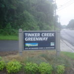
Tinker Creek Greenway from Roanoke River to Wise Avenue
This section of Tinker Creek Greenway begins at a dramatic 660-foot bridge connecting to Roanoke River Greenway. From there, Tinker heads north to Wise Avenue, with an extension into Fallon Park. Special features include the big bridge overlooking the confluence of the two waterways, the opportunities for fishing and bird watching, and the Cyclocross Course […]
Trail Details
Trail Distance:
1.2 mile
Amount of Use:
light
Trail Difficulty:
easy
Surface Type:
Paved
Recommended Activities
Rules, Regulations
& Etiquette
Trail Rules
Some trails cross jurisdictions along route. Rules vary by jurisdiction.
System-Wide Rules:
- Yield to pedestrians.
- Keep to the right, pass on the left.
- Give an audible warning when passing.
- Maintain safe, courteous speeds.
- Keep pets on a leash.
- Clean up after pets.
- Keep the greenway trash free.
- No trespassing after hours.
- No motor vehicles.
- No alcohol, camping, hunting, or fires.
City of Roanoke Hours:
- Hours: 6 am – 11 pm.
Roanoke County Hours:
- Hours: 6 am -9 pm.
General Trail Etiquette
- Share the trail.
- Slow down when congested.
- Do not take up more than half the trail.
- Keep leashes short.
- Wear appropriate safety equipment.
- Step off the trail when stopping.
- Scoop the poop immediately.
- Carry trash to waste receptacles.
×